ZenduMaps
Description
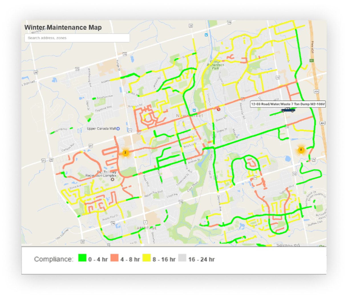
Create and share custom maps with your users using Public Map Share. Configure your maps to show data such as road status, vehicle location, weather reports, compliance times, and others. Use Public Map Share to improve the productivity of vehicle tracking and road compliance for use cases such as winter operations and road maintenance operations by showing your users when roads are plowed, if they’ve been salted, and where the snowplows are in real-time.
Features And Benefits:
• Our map builder lets you decide exactly what features and data you choose to keep track of. Some parameters you can edit include: map title, vehicles/groups affected, zones affected, rules being tracked, routes affected, and many more. Set up as many maps as you’d like to monitor the data and compliance that matters to you.
• When you change settings to your map, they are updated in real-time. No need to administer a new URL to your users.
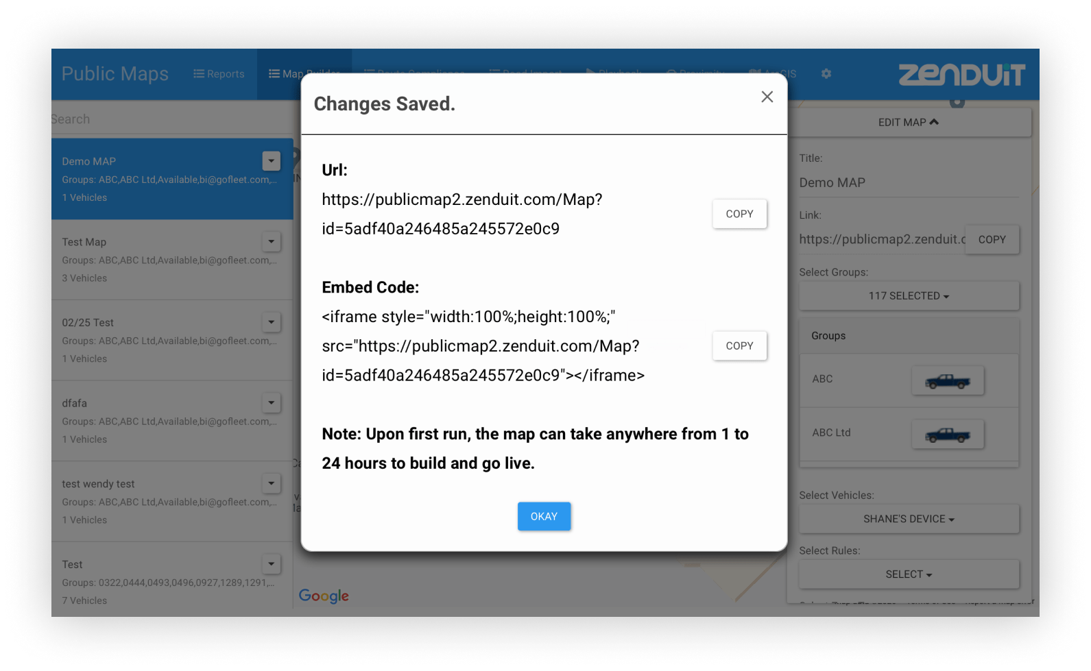
• Your maps automatically generate a unique URL and embed code, so you can decide how your map is displayed. Use your Public Map as a standalone site, or incorporate it to an existing web-page.
• Control how much information is made public with our map editor. Choose how often the map updates, whether vehicles are displayed or not, whether customers can see historical data, and many more options.
• Show when certain road events happened live on the map. Great for showing your users when roads have last been plowed or salted during the winter.
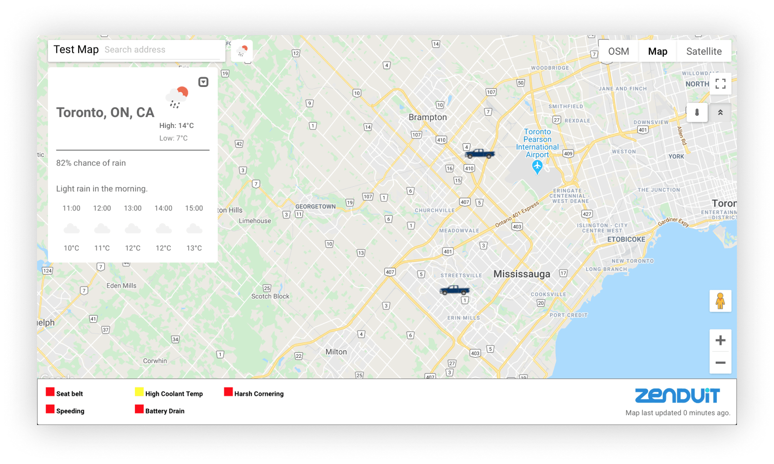
• Choose from 125 icons for each vehicle, add a map legend, or even add a weather widget. Whatever it is, Public Map Share lets you customize your map to show users exactly what you want.
• Control how much information is made public with our map editor. Choose how often the map updates, whether vehicles are displayed or not, whether customers can see historical data, and many more options.
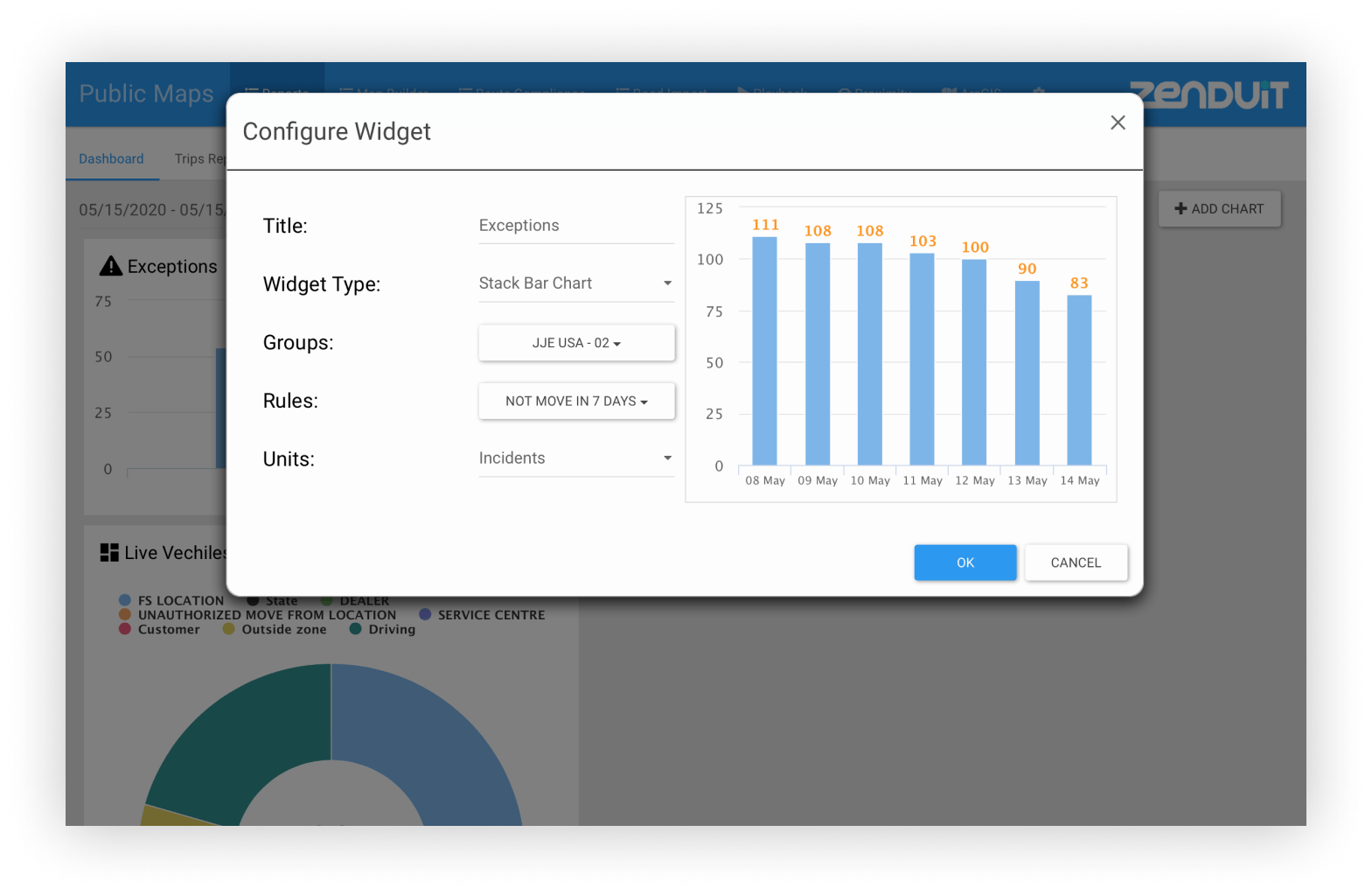
• Choose what data you’d like to see at a glance. With many graph types and rules, you can make your dashboard your own.
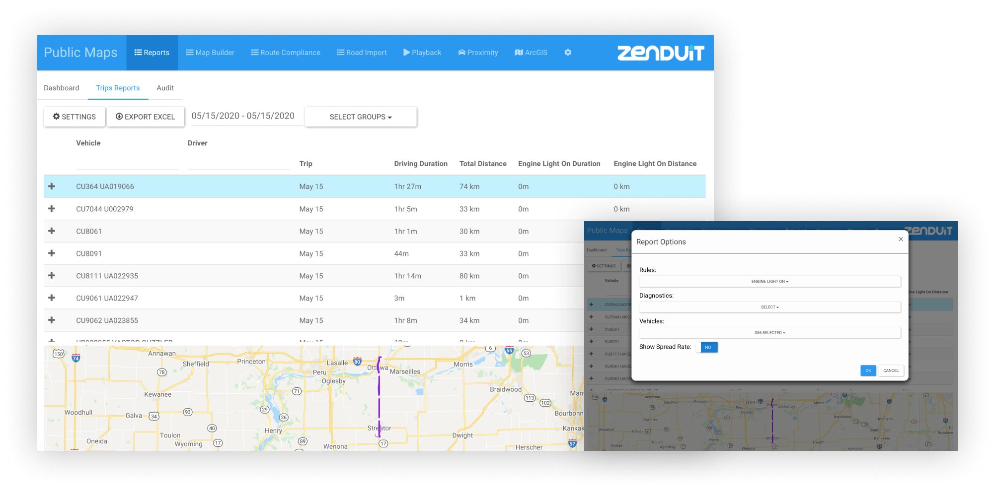
• Track the rules, diagnostics, and vehicles you care about with trip reporting. Selecting a trip displays a mini-map so you can better understand your fleet’s operations.
Compatible Providers

Other Apps


Pricing
Choose a membership
| Free Nil | Base >100 vehciles | Professional >3000 vehicles | |
|---|---|---|---|
|
Monthly cost
|
$0 | $2/vehicle | $1/vehicle |
|
Fixed monthly platform fees
|
$0 | $500 | $500 |
|
One time setup cost
|
$0 | $10K | $5K |
|
For each membership plan:
|
|||
|
Reporting
|
Yes | Yes | Yes |
|
Support
|
No | Email support | Priority Support |
|
TSP Integration
|
Available TSPs* | Available TSPs & paid new TSP addition | Available TSPs and 2 free new TSPs addition |
|
App Integration
|
No | Basic Integration supported | Complex Integration supported |
|
Customer Addition
|
Paid | Paid | Free |